By Robin Bradshaw, The Beaumont Enterprise Staff writer
The term El Niño (Spanish for ‘the Christ Child’) refers to a warming of the ocean surface, or above-average sea surface temperatures, in the central and eastern tropical Pacific Ocean. El Niño is a naturally occurring climate pattern which can significantly influence weather patterns, ocean conditions, and marine fisheries worldwide. El Niño has an impact on ocean temperatures, the speed and strength of ocean currents, the health of coastal fisheries, and local weather from Australia to South America and beyond. El Niño events occur irregularly at two- to seven-year intervals.
The El Niño of 2023–24 is weakening. Forecasters estimate an 85% chance that El Niño will end and the tropical Pacific will transition to neutral conditions by the April–June period. There’s a 60% chance that La Niña will develop by June–August.
Summer 2024 in Texas will officially kick off on Thursday, June 20, and is reported to be the earliest start of summer in 128 years. While Texans can count on triple-digit temperatures, here are a few other weather predictions as the summer solstice takes hold in the Lone Star State.
To predict Texas will endure scorcher-hot temperatures during the summer months is a no-brainer. However, according to NOAA, precipitation forecasts and weather patterns from El Niño and La Niña can create shifts in climate conditions. These shifts are creating a higher likelihood of an increase in hurricane activity for the upcoming summer months forecast.
The entire state is forecasted for above-normal temperatures this summer, the report stated. The rain chances for West Texas through the Rolling Plains are forecasted for below-level precipitation and drought conditions, whereas areas along the Gulf Coast and North Central regions of the state are forecasted for equal chances either above or below, NOAA predicts.
There is a one-in-three chance that 2024 will be warmer than 2023 and a 99% chance it would rank among the five warmest on record, Reuters reported, and as the El Niño conditions likely transition to La Niña during the summer and fall this year, researchers are forecasting an “extremely” hurricane season.
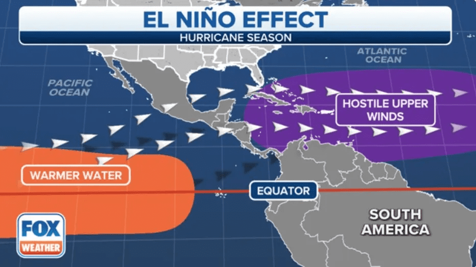
Record-warm sea surface temperatures are present in much of the southern Atlantic, Caribbean, and even part of the Gulf of Mexico helping to active hurricane season.
A second variable contributing to the increased hurricane activity this season is the shift in wind shear from El Niño conditions to La Niña. When El Niño occurs, the wind shear in the Atlantic Hurricane Development Area, which includes the Gulf of Mexico, Caribbean Sea, and southern portions of the Atlantic, is higher than normal, the Climate Adaptation Center report explains. The report adds that typically, during El Niño years, there are fewer hurricanes and fewer strong hurricanes.
When conditions shift to La Niña, the less wind shear results in more clouds surrounding the eye of a tropical storm, which can stack up. When this happens, the storm can quickly intensify, and with warm sea surface temperatures, storms can intensify quickly.